EMSO-Azores Infrastructure description

  • Date of Deployment: 29 July 2010
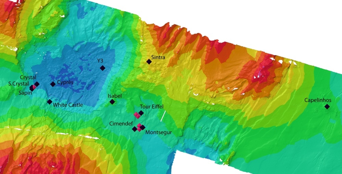
  • Location: South of Azores, Lucky Strike
  • Type: Non cabled observatory
  • Distance from land: 200 nautical miles WSW from Faial
  • Maximal depth: 1700 m
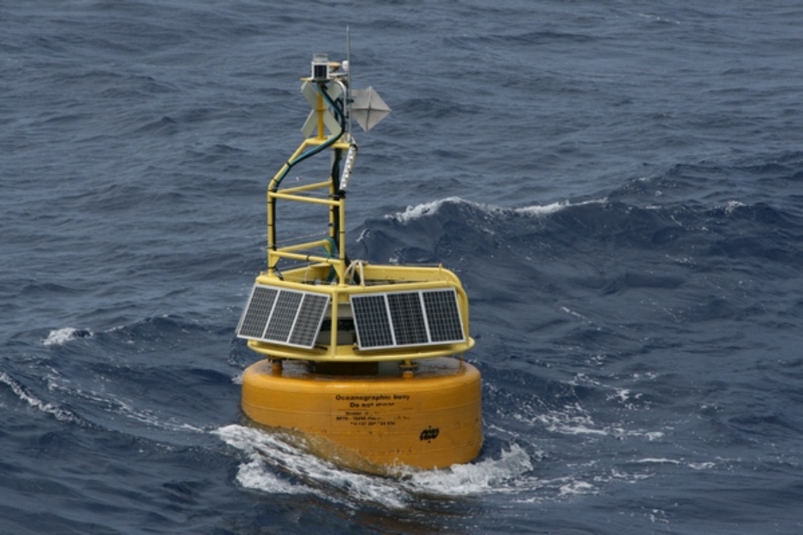
Transmission buoy, BOREL2

Coordinates:  37.3 °N  and  32.28 °W

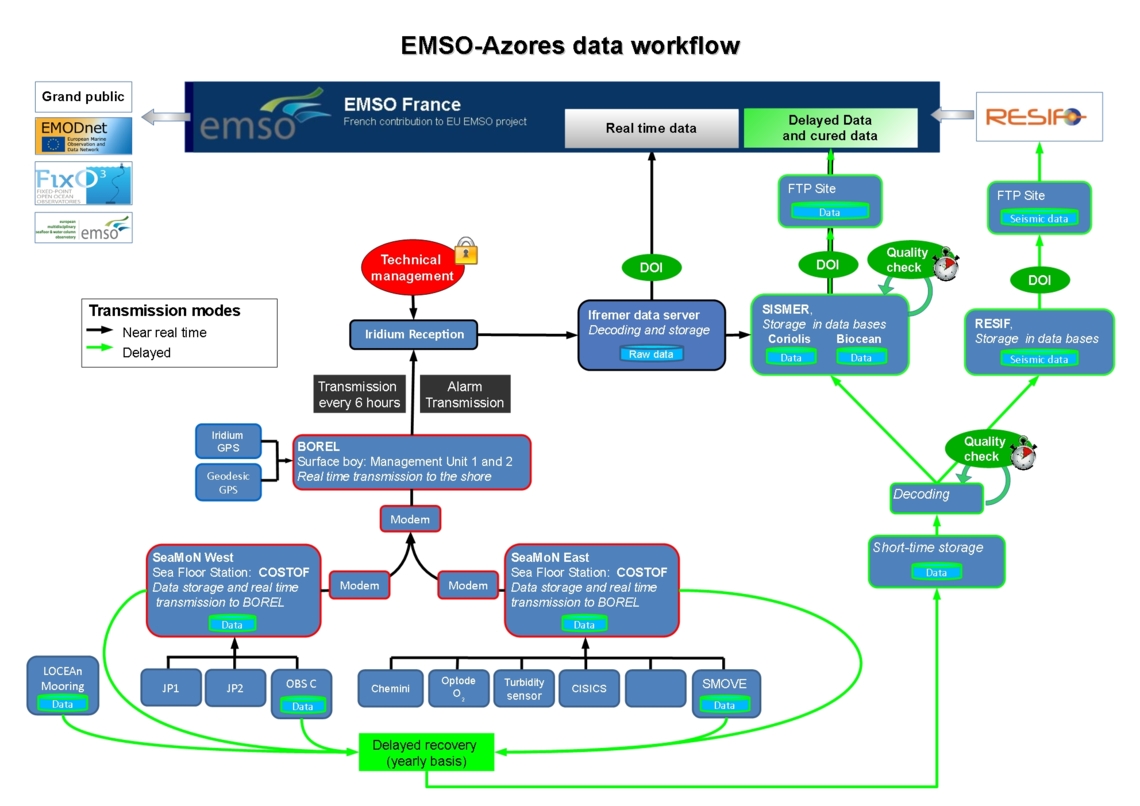
Short description: Borel is the surface buoy, relaying bi-directionally measurement data or commands between seabed and shore, through underwater acoustics and satellite. Borel holds a geodetic Global Positioning System and can host near surface ocean sensors.

  • AIS
  • Geodesic GPS
  • Iridium GPS modem n°1
  • Iridium GPS modem n°2
  • Meteorological station
  • Buoy management unit 1, COSTOF2
  • Buoy management unit 2, COSTOF2
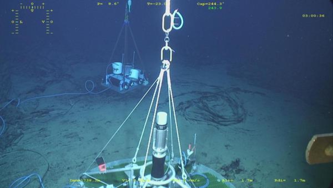
SeaMoN West

Coordinates: 37.291 °N   and  32.279 °W

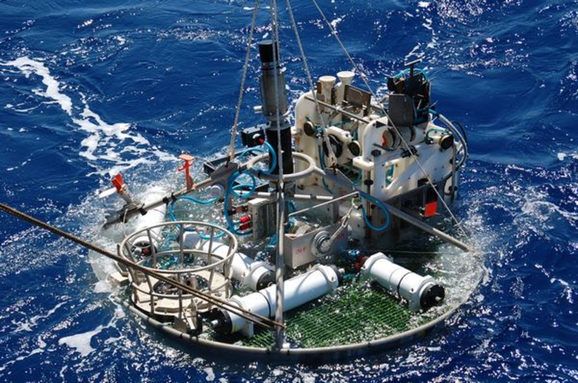
Short description: SeaMoN West is the station moored in the lava lake. Here, an EGIM serves the local set of sensors, generic and specific, and provides bi-directional acoustic communication with the surface buoy. SeaMoN West is dedicated to environmental (EOVs) and geophysical observations.

EGIM with

  • Optode O2
  • Turbidity sensor
  • ADCP
  • Hydrophone
  • CTD
  • Pressure gauge
  • Management unit, COSTOF2

serving additional sensors

  • Short-period Ocean Bottom Seismometer, OBS
SeaMoN East

Coordinates: 37.29 °N  and  32.28 °W

Short description: SeaMoN East is the station positionned at the base of the Tour Eiffel active edifice. It serves the local set of sensors and provides bi-directional acoustic communication with the surface buoy. SeaMoN East is the EMSO-Azores ecological node.

  • Hydroctopus
  • Optode O2
  • Turbidity sensor
  • Video equipment, SMOOVE
  • Gas tight and high pressure fluid sampler, DEAFS
  • Microbial colonizer, CISICS
  • Management unit, COSTOF2
Oceanographic mooring

Coordinates: 37.299 °N  and  32.276 °W

Short description: The oceanographic mooring is anchored  at Lucky Strike and allows the study of hydrographic processes such as as internal tides or passing mesoscale eddies. The mooring is autonomous and is serviced during the maintenance cruise.

  • Temperature, Pressure (-900m)
  • CTD (-1000m)
  • Temperature (-1200m)
  • Temperature (-1450m)
  • Temperature (-1500m)
  • Temperature (-1550m)
  • CTD, ADCP (-1600m)
  • Temperature (-1625m)
  • Temperature (-1650m)
  • Temperature (-1670m)
Autonomous devices

  • Array of OBS
  • Array of temperature probes
  • Array of Ocean Bottom Tilt Current Meters
  • Array of autonomous buttons temperature probes
  • Array of autonomous camera systems
Data policy and access

  • Near real time transmitted data: Free access, no quality check, counter of the number of consultation, 4 transmission per day, download through DOI
  • Periodically recovered data: Free access, previous year data treated by the quality assurance process, yearly recovery, download through DOI
Maintenance

  • Maintenance frequency: 12 months
  • Duration of operations: 20 days
  • Available services: Cruise preparation, lab compatibility tests, implementation on site, data transmission, archiving and dissemination

Read more about the cruises...

Contacts
  • PI: Thibaut Barreyre1, Marjolaine Matabos2, Pierre Marie Sarradin2
  • Data management contact: Thierry Carval2
  • Maintenance contact (Technical supervisor): Laurent Gautier2

1 : CNRS, France
2 : Ifremer, France